TTLS™ Transportable Transponder Landing System
CAT I Precision Guidance for All-Weather Landing in GPS-Denied Environments
AFWERX Phase II SBIR New Deployment Capabilities
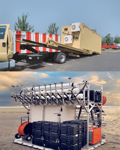
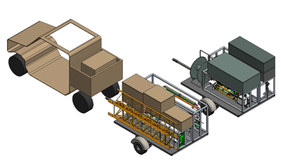
Expeditionary Roll-on/Roll-off from pallet to trailer
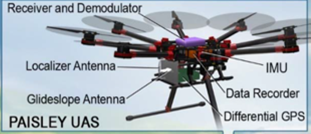
Drone Calibration of TTLS
Optimized Night Ops/IMC
Advanced Navigation & Positioning Corporation (ANPC) is pleased to have been awarded an AFWERX Phase II SBIR for the development of new deployment capabilities for its Transportable Transponder Landing System (TTLS).
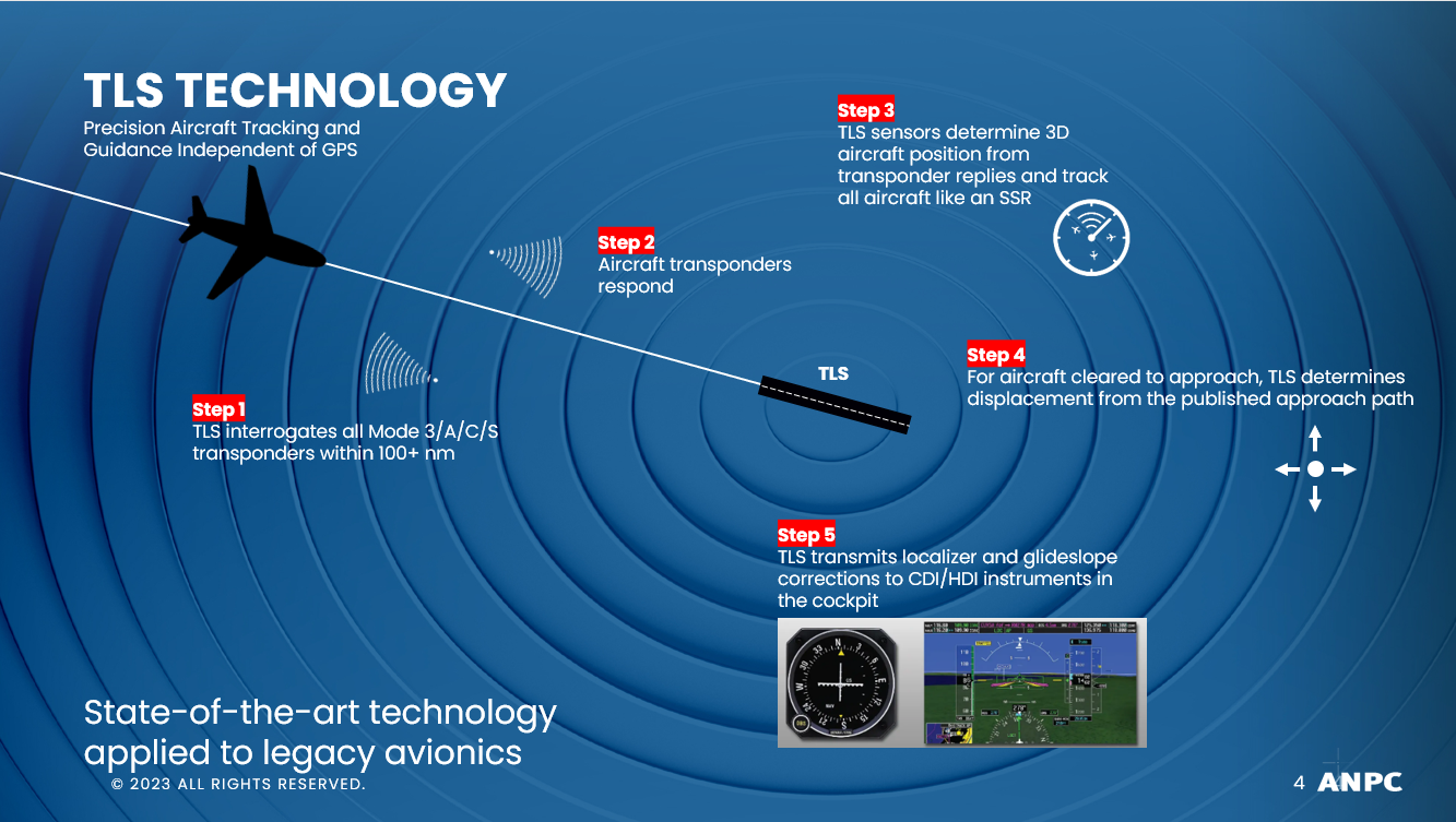
ANPC is the world’s only supplier of rapidly deployable approach guidance and surveillance systems for challenging airfields anywhere in the world. Our family of transponder-based surveillance and guidance systems (TLS/TTLS) combine the functions of an ILS, SSR, and PAR in a single platform and operates completely independently of GPS or any satellite-based navigation. Our transportable systems can be installed in a matter of hours in any runway environment regardless of runway length, terrain, obstacles, or climate conditions.
The new capabilities being developed under this SBIR will expand the system’s transport configuration options to meet mission-specific requirements and further reduce deployment times by optimizing setup and teardown in low/zero visibility conditions, and by streamlining calibration procedures using unmanned aircraft.
Product Overview
The Transportable Transponder Landing System (TTLS) is a precision approach guidance and surveillance system designed to provide all-weather airfield access and situational awareness for improved airport accessibility and safety. The TTLS is capable of being a highly mobile, rugged, and quickly deployable ATC solution for expeditionary forces during contingency operations. The TTLS is designed for GPS-denied environments and used where conventional ILS equipment cannot be sited due to rugged terrain or limited property. The system has the ability to support defense CONOPS including Agile Combat Employment (ACE) and Expeditionary Advanced Base Operations (EABO).
The pilot training and airborne equipment required for TTLS approaches are identical to that for conventional ILS or precision approach radar. The TTLS will track and provide guidance to any IFR-equipped aircraft with a Mode 3/A/C/S transponder, and the instrument guidance is presented to the pilot just as it would be for an ILS approach.
Current Product Features
· ILS and PAR guidance to 20 NM
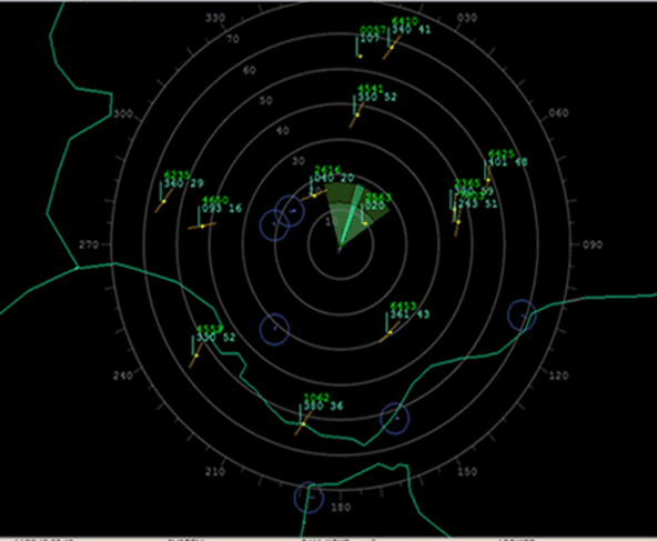
· Area surveillance to 100NM with SSR display
· Sets up and operates independently of GPS
· Aircraft tracking applies multilateration techniques to replies from all Mode 3/A/C/S transponders
· Compliant with all ICAO signal-in-space requirements for CAT I ILS
· Software defined approach includes marker beacon tones
· Supports segmented and curved approaches using RNP design criteria
· Variable glideslope angles supported for obstacle avoidance or rotary-wing operations
· Guidance for up to four aircraft on simultaneous approach on discrete ILS frequency pairs
· Built-in integrity monitor ensures 24/7 accuracy within specified tolerances
· Flies identically to an ILS—no upgraded avionics or pilot training required
· 2-hour setup and teardown for rapid deployment
· Minimal installed footprint adjacent to touchdown
· Can be fully contained in a 463L master pallet for transport
TTLS Product Updates Under this SBIR
Expeditionary—Roll-On/Roll-Off
• Packaged for towing by ATV/UTV and transport on a single mobility aircraft (E.g., C-130, C-17, C-5, V-22, CASA C-295)
• Deployable in 2 hours by 2 personnel with minimal training
• Modular packaging, independent of transport structures and scalable to operational requirements
• Tool-less system
• Packed by install location zones for rapid set up
Drone TTLS Calibration
Rapid calibration using a drone, alleviating reliance on manned aircraft for calibration flights
• Drone will be fitted with a transponder and fly specified calibration flight profiles
• Data collected from drone will serve as truth data to compare with transponder data for calibration
Optimized Night Ops
Streamlined design to simplify setup and operations in low/no light conditions using night vision goggles (NVG), including:
• Component and case labeling with contrast for NVG + color coding for daytime use
• Clear cable labeling and keyed connections
With customers and installations on all seven continents, ANPC has been manufacturing precision approach guidance and area surveillance solutions since 1991. Our products are specifically designed to serve thousands of airfields around the world that cannot accommodate conventional instrument landing systems due to terrain and obstacle challenges. We are a certified small business, and all system design, testing, and production are conducted at our corporate headquarters in Hood River, Oregon. All systems are in full compliance with ICAO performance requirements for CAT. I Instrument Landing Systems.

Copyright © 2022
Advanced Navigation and Positioning Corporation

